The Canon de Colca is one of Perus natural highlights as they say. It is very often compared to the Grand Canyon. But other than his famous colleague in the US this canyon is not located in a flat area. It is surrounded by the Andean mountains towering with 5200m over it’s river bed. This creates an incredible sight.
The tourists get there by bus from Arequipa as a one or 2-day organized tour.

For us on the bikes there are other options of course and so we take a long dirt road via Huambo. We start in Camana driectly on the coast very early in the morning. After 80km on tarmac we turn off to a dusty gravel road. It has quite a lot of corrugations and so our bikes get shaken pretty well.
The road climbs up the mountains and slowly the desert gets a more and more spots of vegetation. Small bundles of grass start to grow and once in a while even a little bush finds enough humidity to live here.
Little flowers contribute yellow spots to the brown of the grass and dust.
After we have about half of the dirt road (80km) the road gets steeper and we start noticing snow covered mountains around us. It turns out to be the surrounding volcanoes, some of them reaching more than 6000m. The landscape is fantastic. A mountain pass at 4200m offers a breathtaking view into a broad valley, which ends in the far distance with a sharp edge, the first sight of the Calco canyon. We make a break, but after being on the coast at sea-level for more than a week, we are pretty out of breath. We continue on the road which is getting more rough but with less corrugations which makes riding actually more enjoyable. There are hardly any cars here. During the 6 hours we spend on the bikes we only saw a handful of cars or trucks.
As we descend from the mountain pass we enter the little village of Huambo. Lots of people in traditional clothing are gathered on the Plaza del Armas, the main plaza. Traditional music is being played from loudspeakers and a lady is commenting the appearance of little dance groups. Trucks and even a bulldozer are setup as floats parading in front of the inhabitants of the village. It is the 124th anniversary of the village and they are celebrating it very nicely. We stand somewhere on the side and get in contact with people immediately. So we stand there, drink some coke and eat some cookies, which we bought from the store next to our bikes and watch the parade going on.
It is really nice and enjoyable.
After a while, just before the parade is finished we jump on our bikes and continue the last 30km to Cabanonde.
The place we stayed is famous for its kitchen (Kuntur Wassi) and so we had a delicious dinner of Alpaca meat. We got up early in the morning to reach a steep cliff. When the early sun hits the canyon condors use the thermal lift to rise up and go hunting. As we approach the Cruz del Condor there are already a couple of tour busses waiting. We jump off the bikes and just make it in time to see some of the huge birds flying-by real close. It is an impressive sight to see this majestic birds sailing in the warm wind.
After 15 minutes the birds are gone. Time to see what else there is to see. The canyon is incredible: deep down you can see the Colca river a 1200m below. Above it the 5200m high Senal Ajiruha mountain towers over the canyon. There are some frozen waterfalls up there. It is almost unreal as the rest of the area is quite dry. We enjoy the view for some more time and keep going following the route of the busses back to Arequipa.
The Canyon gets wider and lots of terraces are build into the walls. It turns very green with all these fields. It is one of the main agricultural areas of Peru. We reach the next town that is at 3600m and fill up our bikes. Then we start the ascent on asphalt now, up to the 4800m mountain pass of Patapamba. The ride is incredible, with great views into the valley of the Colca canyon. The top is quite flat and offers a fantastic sight to the volcanoes surrounding the area.
As we don’t want to take the long main road to Arequipa we decide to take a little short cut. A dirt track leads in between two massive volcanoes (Misti 5800m and Chachani 6000m). The road is pretty good and almost flat so we proceed very well. As we hit the flank of Chachani it gets pretty sandy at some parts though. It is not real sand, it is ashes from the volcanoes and it is very very soft. Christy had some difficulties and I fell twice as well. Since we were at 4000m altitude picking up the bikes was quite a strenuous work.
But most of the time the road was very rocky and so we made it back ok to tarmac and then into the nice city of Arequipa.
We decided to stay a full day there to “recover” from all the incredible sights and rides we have had the last week.

Leaving the coast direction Arequipa

We take a little dirt road to Huambo

The road is good but has a lot of corrugations.

The volcanoes start to show up.

A mountain pass at 4200m offers a great view into a broad valley.

The landscape stays fantastic and everything is in large scales.

Christy is doing great on the gravel. So we are travelling quite fast…

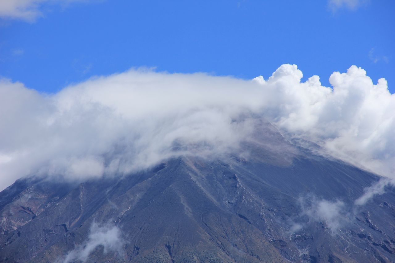
Beautiful volcanoes.

Some of the volcanoes are puffing their smoke signs into the sky.

Kids at the parade in Huambo

Cars and trucks are decorated.

Enjoying a chat and a cold brew.

Local visitors in their traditional clothing.

We had a nice chat to this lady.

Another mountain pass had to be climbed to reach the town of Cabanaconde.

The Colca canyon.

We got up early to see one of these guys.

Majestic as they sail through the warming air.

Colca canyon is one of the important agricultural centres of Peru.

Flora is showing it’s beauty and it’s thorns

What a contrast to the thorns: these soft shapes.

A mountain pass of almost 4900m leaves us a great view on the volcanoes.

Little mini tornados dance around the plateau.

Vecunas, the little sister of the more known Lama are everywhere.

Fantastic roads, long stretches that let your thoughts escape.

A shortcut of 80km off road shall bring us to Arequipa.

The Misti, a wonderful shaped volcano is constantly in our view.

riding gets difficult at parts.

Very soft volcano ash is making it hard to stay on the bike.

More cute animals on the way down to Arequipa.

Our little garden. Peaceful, calm, and with a cute soccer playing turtle.