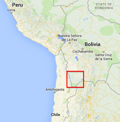
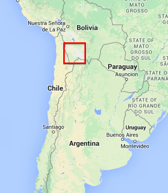
Uyuni to San Pedro de Atacama
Riding north to south it seems a logical route to go from Uyuni to San Pedro de Atacama in Chile. It is fantastic ride, don’t miss it.
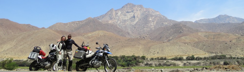
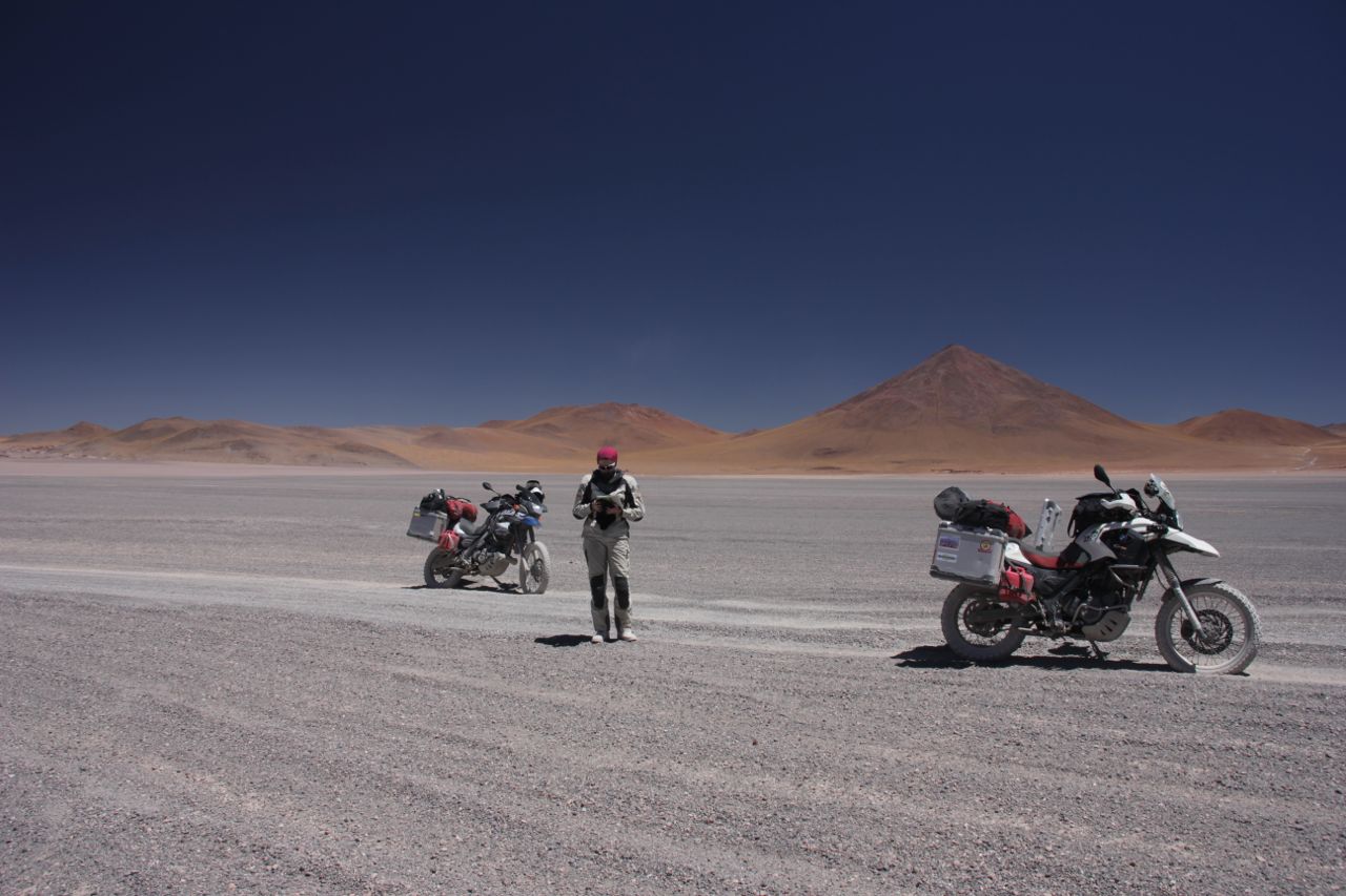
Here are some pictures from our trip.
Below there is some information about the ride. But first let me give you some general information:
The internet is full of reports about this area. A lot of people who did the ride had a hard time and that’s what they write. Don’t hesitate of doing it though.
With the right preparation everybody can do it on every bike (maybe not a Goldwing or a racebike).
Update: after I got an email of Bob, a great fellow, aged 74, who asked me about some details I would like to add one more sentence here: if you are not an experienced off roader, you have to be prepared to pick up your bike a few times. Little falls just may happen. At altitude of constantly over 4000m (13000ft) and at times over 5000m (16000ft) that might be strenuous. Take your time, take it easy and you are fine though.
We did it on a F650GS Dakar and a G650GS. We had Heidenau tyres which were quite low on profile.
My girlfriend made her license not a year before the trip. She had little experience before the trip and one long weekend offroading with a little Beta200. So you don’t need to be an expert at all. Just prepare and take it easy.
What you need is:
- Fuel for 500km (we simply bought two 5L fuel cans that we strapped on the bike)
- Enough water (we had 4L each)
- Some money for the overnight stays (be reminded that you enter a national park where you have to pay 150Bs entrance).
- Some snacks to keep you going during the day
- GPS maps of the area (OSM has a good map which turned out to be very precise in this area). (The paper maps from Reise-Know-How are crap for this part of the journey).
Take your time. We made it in 3 days, which was quite relaxing.
Don’t be worried if something happens: There are many 4×4 running these roads as this is a very common touristic thing to do in organized tours (see below), so there is always help if needed. People will stop when you give them a sign. You can also ask them if you are unsure about directions. Just stop an wait a little bit. There will be someone coming.
The most4x4 tours make the loop: Uyuni-Salar-San Juan-Laguna Colorada- Laguna Verde- Villa Mar-San Cristobal-uyuni(3 days).
The 3 options:
There are basically 3 ways from Uyuni to San Pedro de Atacama.
- The Lagoon route via San Juan
- The route via San Cristobal
- The route via Tupiza
- The lagoon route is the by far most sandy one. It has a stretch of more than 60km (depending on the conditions up to 90km) sand. You pass a lot of lagoons and this is the route the 4×4 take from Uyuni via San Juan to the Laguna colorado all along the Chile-Bolivia border. You also pass the famous Arbol de Piedra, a rock formation that looks like a tree. For motorbikers this is the most strengous version.
- San cristobal route: This route is the one we took. It seems to be the easiest one. The first bit is in very good condition (almost like a paved road) and there are only short sandy bits of road (max. 1km). Most parts of the road are rocky and easy to ride. You pass a nice lagoon and some incredible rock formations that are certainly as spectacular as the Arbol de piedra. You can devide the road in 3 days or do it in 2 days (but that would be pretty hard or you are experianced off roader).
- The route via Tupiza is also pretty sandy, not as much as the Lagoon route (I was told by a 4×4 tourguide). It brings you to places where Butch Cassidy and Sundance Kid lived and died. This route I have the least information on, but for people who are experianced offroaders and who want to spend some more remote time this would be the route. There are not as many 4×4 tours on this road.
Info Laguna Colorada

Flamingos, thousands.
Route 1 and 2 are meeting at the Laguna Colarada.
There is a camp there (S22° 10.260′ W67° 49.049′) where all the 4×4 groups stay. Simple rooms usually as dorms, but you can also rent a complete dorm for yourself if you want to have some privacy.
There is another one (calls himself a hotel, but is not better than the camp(Info from a 4×4 tour guide) south of the Laguna Colorada (S22° 15.802′ W67° 48.961′). Here you can also buy water and snacks.
Close to the camp there is a lookout (S22° 10.222′ W67° 48.279′).
DO NOT MISS THAT. If you are doing route 2 go around the laguna (or take a short cut on the north side of the laguna) and go there. All the tourists go there so the place gets crowdie at times, but this place is incredible. The colors of the lagunas are in general better in the afternoon, as the strong afternoon winds stir up the water and the bacteria in it which create the great color
Detailed describtion of Route 2:
Uyuni – San Cristobal – Villa Mar – Laguna Colorada – Camp Laguna Colorada – Geysers – Laguna Verde
The road leaves Uyuni south west direction. You pass a gas station (S20° 28.174′ W66° 49.200′) and leaving the town. The road is in very good condition. You can easily go 80km/h. In San Cristobal there is a gas station, but it does not always have fuel. So don’t count on it. But if you have very little reserve, you can try to get some fuel here.
There are also some shops where you can get water.
Shortly after the town of Villa Alota take a left (at S21° 23.974′ W67° 36.893′).
The road gets rougher now. A little bit of dust and sand is on the rocky road, so take it easy. Shortly after the turn off there is a water crossing. It is approximately 40cm deep and rocky. So you may get your feet wet. They are building a bridge there, so end of 2014 you may have a less adventurous crossing there.
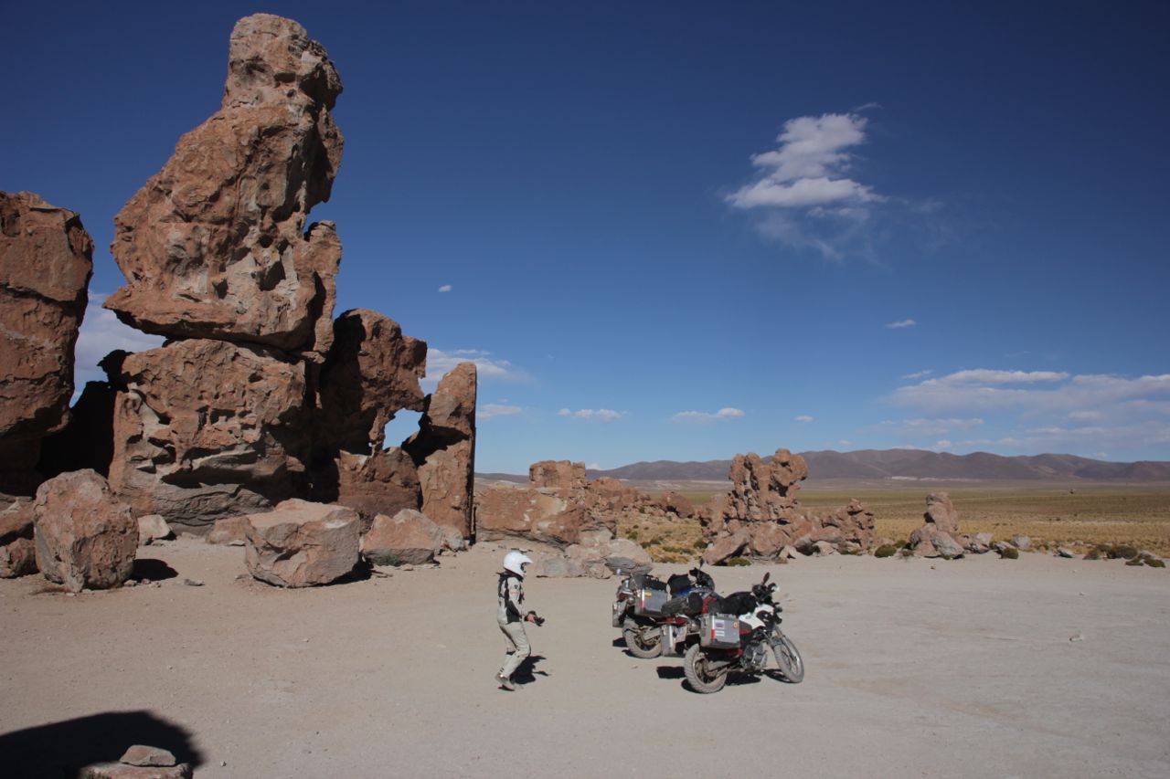
The road gets up the mountain and soon you will see amazing rock formation right next to the road on your right hand side (S21° 32.155′ W67° 34.742′). If you plan to camp, this is an excellent place.

The following part of the road is a bit sandy at parts, but never long stretches. And the sand is never really deep. So you can “powerwalk” through the sandy parts.
In Villa Mar there are a couple of simple B&B. The tours stop here on the way home from the Laguna Verde. We stayed here in a simple B&B at the end of the town and had a great meal in the evening and a good (simple) breakfast. You can also buy water here.
Shortly after Villa Mar you have to turn off the main road. The turn off is here (S21° 46.208′ W67° 27.818′).

Turn to the right and follow up the hills into a beautiful little valley which I like to call “Lama paradise”. If you get there, you know why. The road gets pretty rocky here.
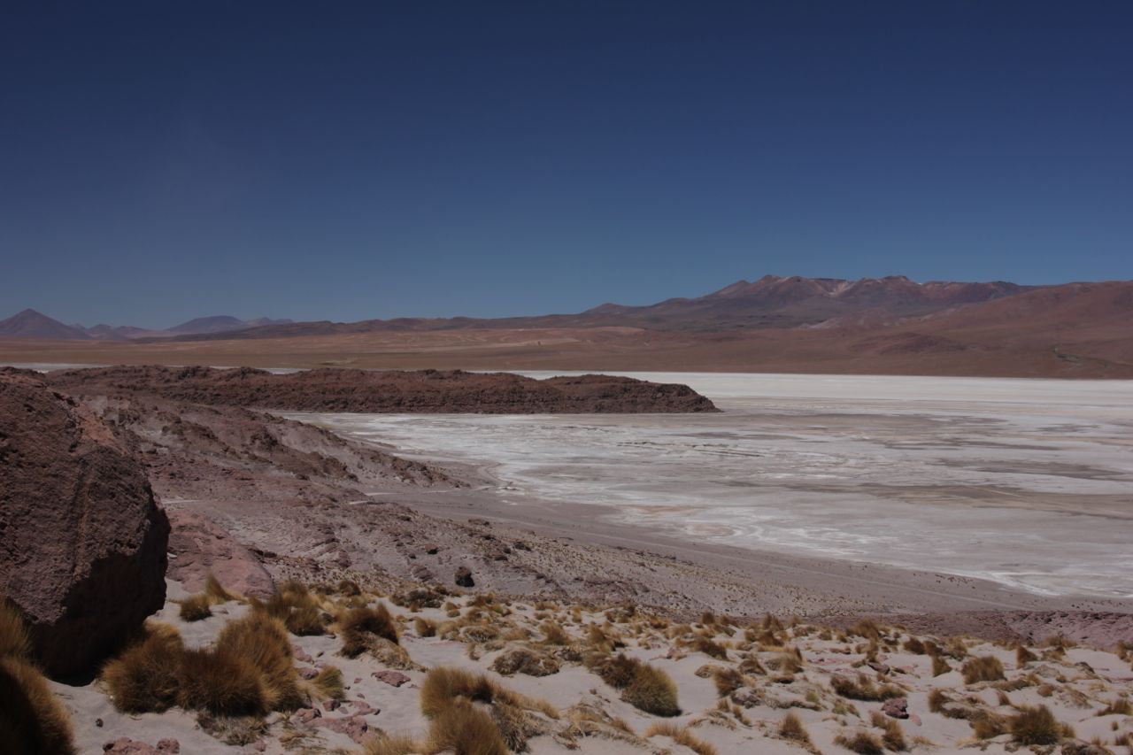
After a few kilometers you arrive at the first lagoon (Laguna Capina). You have a nice view on it. So make a break and enjoy the view.

A first lagoon
After you have the lagoon behind you a pretty sandy strech begins. It is pretty much the worst part and it will bring you into the national park. There is a guy living here in a small hut. You have to pay him some money and you get a ticket. Don’t loose it. It will be checked on the way out (some told us, we were not checked).
Shortly after the entrance of the national park you hit another junction. You have to take a right here. The main road is where most of the 4×4 tours come back from Laguna Verde directly. So following the main road means you miss Laguna Colorada (and you don’t want to miss that!). If you have doubts, wait until the next 4×4 arrives, stop him and ask for directions. I think the junction is approx. here (S22° 09.125′ W67° 39.732′).
This will bring you to the laguna colorada. Don’t miss the viewing point (S22° 10.222′ W67° 48.279′) and stay a night here. Watch out, the way from the camp to the lookout is best on foot (500m from the camp). The road there is really really sandy. (deep sand).
It is worth it. Going around the laguna is pretty sandy. There is a track right north of the lagoon. I have not checked it out, but it would be worth a try. It would be a lot shorter than around the lagoon. (More info see chapter INFO Laguna Colorada)

The bit around the Laguna is pretty sandy.
After a cold night at the Laguna Colorada the road goes up the mountain. As soon as you have left the laguna the sandy bits are over. No more sand.

Leaving the Laguna Colorada up the mountain.
There is the Aduana (S22° 26.454′ W67° 48.357′) but you DO NOT NEED to go there You can do the customs directly at the border since 2014!
There are some geysers (S22° 26.002′ W67° 45.696′) and they are most active in the morning. So 4×4 tours start at 4am. We took it more easy and it was still impressive.
You pass another laguna (Laguna Chelviri) with hot springs. At the hot springs there is a little shop and you will find dozens of 4×4 from organized tours.
Shortly after that on your left hand side there is a fantastic rock formations on complete flat sand. For a reason this is called Disierto Salvador Dali. Its quite nice.
Finally the road leads between the Laguna Verde and the Laguna Blanca. Its a real highlight (S22° 47.292′ W67° 49.067′).

The Laguna Verde. The strong and cold wind stirred up the colourful lagoon.
The road goes along the south side of the Laguna Blanca and is a bit soft (the road on the north side is a bit better id guess), but no bigger problem. Just take it easy. It is not far to tarmac anymore.
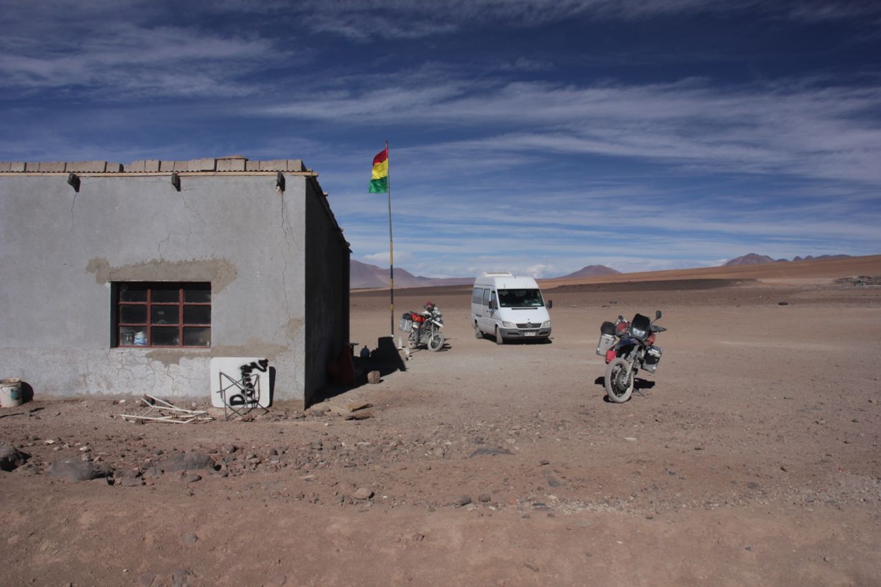
The border is not far away, just up the hill (approx. S22° 52.434′ W67° 47.426′). Not to miss. It is a small building in the middle of nowhere.

The little border crossing to Chile.
The border stuff for Chile you do in San Pedro de Atacama. Here:( S22° 54.666′ W68° 11.615′). BEWARE: you are not allowed to bring any fruits or seeds with you.
We did this route, and I didn’t have the feeling of missing something. I saw enough lagoons, and instead of the Arbol de Piedra we saw fantastic rock formations. But if you want to learn to ride sand you’d certainly should do the route 1.
GPX Tracks:
The tracks are found here:
http://www.wikiloc.com/wikiloc/view.do?id=8390836