Fjords, ferries and dead trees

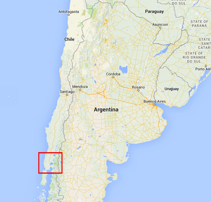
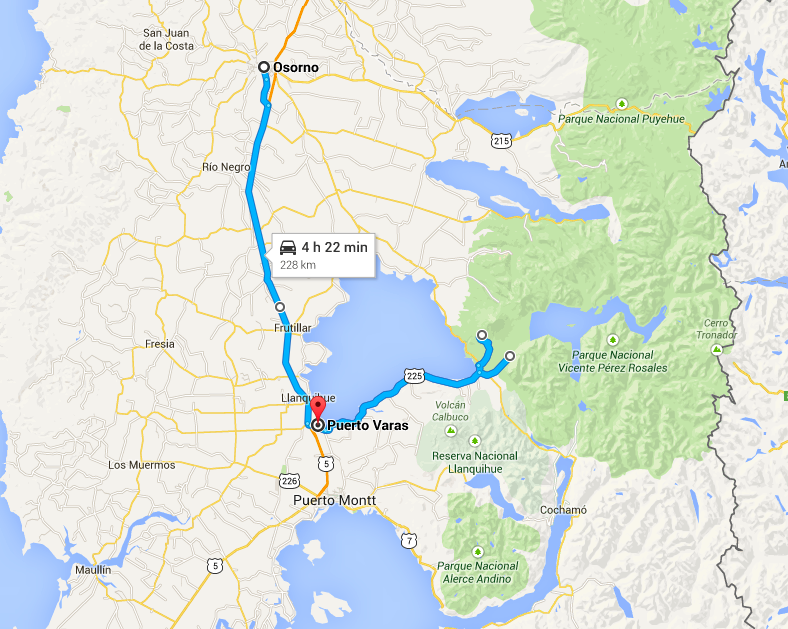
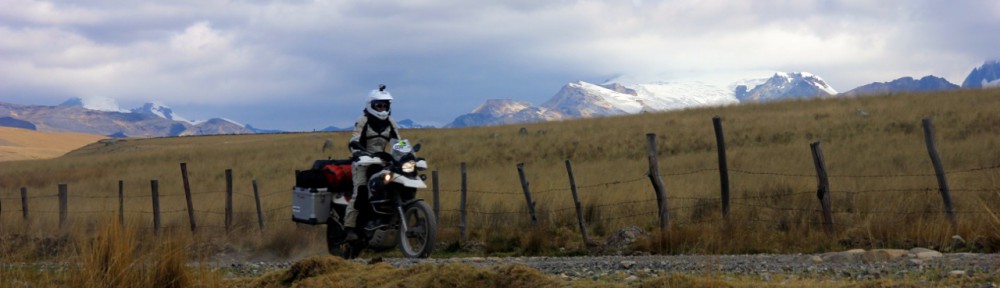
Puerto Varas – Hornopiren -Chaiten

Screen Shot 2014-12-29 at 11.50.44

The southern part of Chile consists of high mountains that arise directly from the sea. Many little islands and deep fjords form the outline of the coast. So years ago, the few little villages that exist here were only reachable by boat or little planes that had to curve between the mountains to land on gravel runways.

It had been like this until the 70’s. The dictator Pinochet wanted to strengthen the presence in these areas for strategic reasons and he therefore ordered to build a road here. And so a road, the Carretera Austral now leads to one of the most beautiful places in Chile and therefore we clearly didn’t want to miss it.

The road is mostly a gravel road with lots of pot holes, but it is getting improved constantly and so many parts are paved nicely in the meantime.

It is not really connected to the rest of Chiles road system. You need to take in total 3 ferries to get to the real start of the Carretera Austral.

We took the first ferry, a short crossing of 30 minutes and went south on a good dirt road that brought us to Hornopiren.

The town of Hornopiren is a nice little place. There is a little fish farm, some grocery stores and the little harbor. It is located beautifully at the end of a large fjord. An island separates the fjord into two arms. It was cloudy, we would only get little partial views on the surrounding mountains.

The town has a real pioneer flair. I feel very reminded of the small towns in northern Canada. Simply constructed little houses and a very slow pace. Nobody is in a hurry here. When you stand on the side of one of the few roads cars would stop to see whether you would maybe like to cross the street. Drivers friendly smile and slowly continue when you signal them that you are just standing there to take a picture of the bay.

We found a nice little cabin. It was cozy even though the bathtub was about to crash through the floor and the carpet was full of dirty spots. We stayed there for two nights and just relaxed during the day.

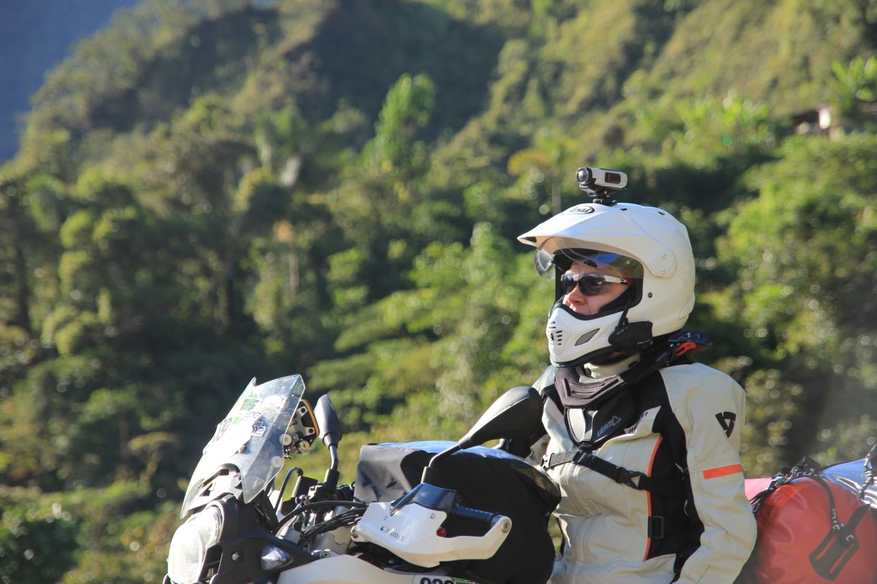
The ferry would leave at noon and so we boarded the bikes and enjoyed the boatrip through fantastic fjords. We were lucky enough to meet the captain who invited us on the bridge and so we had a very special view and a great chat to the captain and his pilot.

The time flew by and after three hours on the ferry we and a whole lot of other local travellers got on a dusty gravel road just to reach another ferry not 20km down the road. The second ferry took only 30 minutes though and so we finally reached the northern part of the Carretera Austral.

This part of the road leads through the Pumalin National Park. This park not only has a fantastic landscape but also an interesting history. Douglas Tompkins, the founder of The North Face has bought large areas here and after some difficulties and skepticism of the locals eventually created this national park.

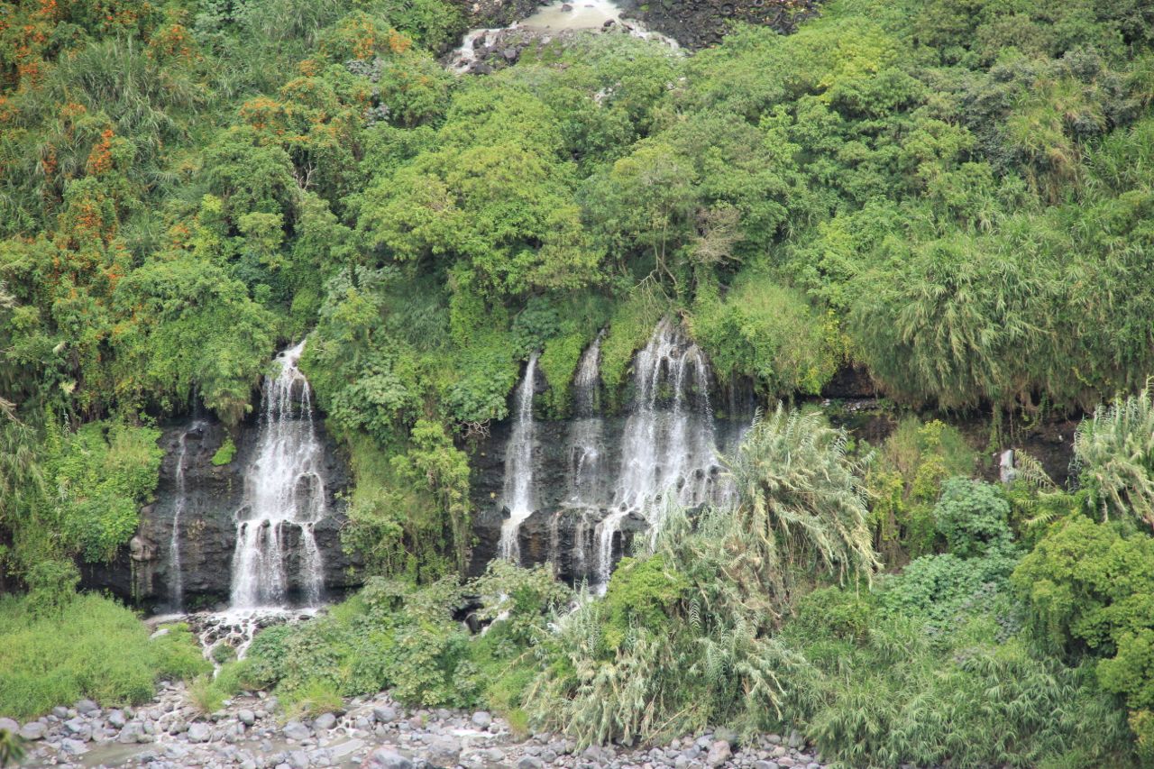
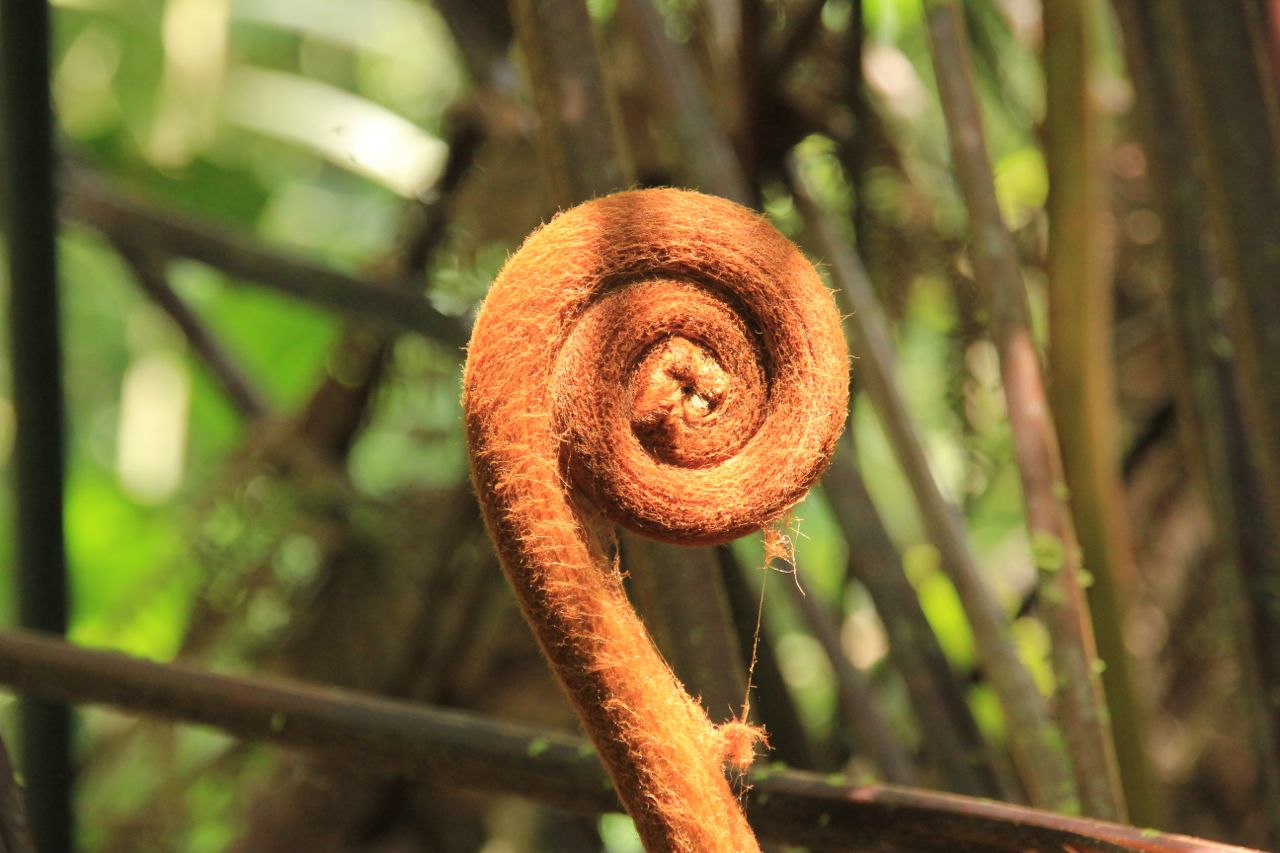
It is a fantastic area. The road cuts through thick vegetation. Leaves as big as me are next to the road. Gorgeous lakes, rivers and mountains left and right. The road is in good condition and there are many fantastic campsites. We are early in the day though and so we keep on going.

Suddenly an almost shocking change. Riding down a slope we get to what appears a river valley. But the green is gone. All the trees are dead. The riverbed is full of trunks that lay on each other chaotically. This is ground zero of a disaster.

Indeed: 2008 the Chaiten volcano suddenly erupted with little warning. Large areas were destroyed and the town of Chaiten completely vanished.

It is quite impressive to ride the bike through this landscape. But when I said there is no green that is not entirely correct. Mother nature is already coming back and small bushes and plants are starting to heal this scar.

Early in the day we arrive in the new build town of Chaiten. We find a nice restaurant for an early dinner and since the owner also rents rooms we have found our place to stay as well.

Other travellers join us on a beer in the evening and so it is a nice chatty evening with interesting people.

Lakes and volcanoes

Osorno – Puerto Varas

Screen Shot 2014-12-23 at 13.40.47 Screen Shot 2014-12-23 at 13.39.29

Osorno is not a very pleasant town. We only stayed here to get new tires and to get our steering fixed. Motoaventura is a BMW dealer and rents motorbikes as well. They had the spare parts ready, the tires we wanted on stock and they made a good and quick job.

We waited a few hours till everything was done, but the time flew by as a lot of other travellers (most from Argentina) stopped by and so we had a great time there. We were served coffee as well and had a fantastic lunch on a restaurant nearby.


We were glad that we did not have to stay another night though as the town has nothing to offer and so we continued to the Lago Llangquihue which is close by. The lake is incredible. It is pretty big and a fantastic snow covered volcano is towering on its eastern side. This whole region has been settled by Germans and they keep their traditions. So you find Bavarian restaurants, coffee shops offering “kuchen”, and a lot of names are German. We had a short stop in the town of Frutillar for a coffee in a theatre built directly at the water. It is a great building and it seems to be a fantastic theatre, offering room for 1600 people. We wondered how this little village would look like when 1600 people arrive there for the evening event.

The town of Puerto Varas has a fantastic view on the volcano as well. We stayed there and made a daytrip to the volcano and some neat waterfalls nearby.

We took advantage of the German influence and enjoyed an “Erdinger Weissbier” in the evening.

Big fat cows on green meadows

Salto de Laja – Villarica-Osorno

Screen Shot 2014-12-21 at 22.36.37 Screen Shot 2014-12-21 at 22.45.53

Just a week ago we had passed the Atacama desert, on of the driest areas on this planet. And now this: all shades of green. Big trees, high grass, thick bushes.

And all among it: cows. Lots of them. Big fat cows. And sheep.

This is cow paradise. We drove along a nice road, the sun was shining, it was warm, almost hot.

The road passes fantastic lakes with high snow covered mountains sorrounding it. This looks like picture book Switzerland except you won’t find a perferctly shaped volcano there.

We rode the bikes along the shores of Lago Villarica and Lago Ronco. The lake district of Chile is a fantastic area. And after all the desert that we have seen on our trip this is exactly what we our souls were thirsting for: lots of green and lots of water. We had sunshine all these days as well and the roads were in perfect condition. And so Christy came to the conclusion that if you could ride a bike in heaven, it would be just like here.

Waterfalls

NP 7 tazas – Salto del Laja

We arrived at a very nice campsite just outside the NP “Siete tazas”. The name translates as “seven cups” describing the river as it falls in several spectacular waterfalls into little bowls that the river had carved out of the hard rock here.

We camped and had a nice evening with 2 guys from Israel before we took our bike to the entry of the national park. A little hike brought us to a canyon. A small trail led through a colorful forest and down the canyon, offering fantastic views on the waterfalls.

We continued south and after a stretch on the PanAm we found a nice hotel close to another great waterfall, the “Salto de Laja”. Our hotel happened to be right at the edge of one side of the waterfall and we had a view on it directly from our room.

The next day we wanted to have a better look at it.

It was closed though. As we approached the gates we could see a lot of people with tired and sad expressions. A police officer stood in the entrance of a little path that led to the waterfalls. A rescue vehicle stood aside.

A little girl of 13 years age fell into the water underneath the waterfall and had been pulled into a powerful undertow the day before. She was still trapped there and we could hardly imagine what the poor parents went through, sitting there and waiting for the officials and rescuer to bring them the body of their daughter.

We felt very bad, standing there with our cameras, excited tourists that hoped to see a great natural site… and there the poor family going through the most unimaginable pain.

We turned our bikes around and left.

It was a quite ride and we both wished the best for the poor family.

Salt

It is unreal! I can feel the wind. I can feel the engine working hard underneath me. I feel the vibrations of the wheels spinning at 80km/h. I know I am riding a motorbike and I have it all cranked up. I go as fast as this 400ccm Honda dirt bike runs.

And still: I don’t seem to move.

I see the hexagonal shaped salt structures fly by and I know I am moving.

But the vast, completely flat, white and endless surface of the Salar doesn’t give my brain the usual information that we usually combine with moving. Everything that I can see except the ground seems to stand still. This place really plays tricks on your mind.

I am on the Salar de Uyuni.

It is the largest salt lake in the world and it is a magic place.

Screen Shot 2014-11-24 at 18.47.55

Originally we wanted to ride our bikes to one of the islands there and camp overnight. But we were unlucky with the weather. The evening before we wanted to go heavy rain softened the surface of the Salar. That is not a problem in terms of riding. But the salty water would get everywhere on the bike, causing problems everywhere, especially on the electronics.

We decided instead to rent some small 400ccm dirt bikes.

So the day after we rode our bike to MTB where Juan, our guide, was already waiting for us.

They have a really nice workshop there and a couple of different bikes.

We chose 400ccm Hondas and took off. We made a nice little loop on sandy roads to the eastern entrance of the salt lake.

Other than one would expect, you cannot enter the salt lake everywhere. There are only few entrances to the salt lake. Close to the land the salt surface gets very soft. Only few parts are solid. It is actually quite dangerous in some areas and a lot of people had to leave their bikes out there.

As we entered the Salar, we could see that large areas were covered in water. The salty water splashed over the bike, leaving a very thick rust of salt. You had to know the way very well. Once I got maybe 5m off the track and sank into the salt surface. I got out of the situation luckily by opening the throttle all the way.

On one of the little islands we had lunch. There are dozens of 4×4 standing around pouring hundreds of tourist on the little island. But that doesn’t reduce the magic of the place in any way.

In all directions it is white and flat. In the far distance you can see volcanoes that circle the salt lake.

The volcanoes are also one of the reasons why this is an important place for bolivian industry: the salt of the lake contains 70% of the worldwide lithium resources.

The surface is not entirely flat. When the salt had dried out some 20.000 years ago, it grew in hexagonal crystals which grew until the edges met each other. Water from underneath the salt lake moves up through these border lines, leaving salt crystals on the surface as the water vaporizes in the sun. The crystals stand out as high as 10cm, showing a pattern of hexagonal little walls as far as the eye can see.

Riding on the salt lake is like on tarmac. Not slippery as one could imagine. And it is great fun.

But we are happy we didn’t bring our own bikes. The small Hondas were covered in a thick salt layer.

We return to our little hotel after dark.

It was a perfect day and we need some time to allow the brain to accept that this place is real.

High mountains and deep canyons


The Canon de Colca is one of Perus natural highlights as they say. It is very often compared to the Grand Canyon. But other than his famous colleague in the US this canyon is not located in a flat area. It is surrounded by the Andean mountains towering with 5200m over it’s river bed. This creates an incredible sight.

The tourists get there by bus from Arequipa as a one or 2-day organized tour.

Screen Shot 2014-11-07 at 20.59.55

For us on the bikes there are other options of course and so we take a long dirt road via Huambo. We start in Camana driectly on the coast very early in the morning. After 80km on tarmac we turn off to a dusty gravel road. It has quite a lot of corrugations and so our bikes get shaken pretty well.

The road climbs up the mountains and slowly the desert gets a more and more spots of vegetation. Small bundles of grass start to grow and once in a while even a little bush finds enough humidity to live here.

Little flowers contribute yellow spots to the brown of the grass and dust.

After we have about half of the dirt road (80km) the road gets steeper and we start noticing snow covered mountains around us. It turns out to be the surrounding volcanoes, some of them reaching more than 6000m. The landscape is fantastic. A mountain pass at 4200m offers a breathtaking view into a broad valley, which ends in the far distance with a sharp edge, the first sight of the Calco canyon. We make a break, but after being on the coast at sea-level for more than a week, we are pretty out of breath. We continue on the road which is getting more rough but with less corrugations which makes riding actually more enjoyable. There are hardly any cars here. During the 6 hours we spend on the bikes we only saw a handful of cars or trucks.


As we descend from the mountain pass we enter the little village of Huambo. Lots of people in traditional clothing are gathered on the Plaza del Armas, the main plaza. Traditional music is being played from loudspeakers and a lady is commenting the appearance of little dance groups. Trucks and even a bulldozer are setup as floats parading in front of the inhabitants of the village. It is the 124th anniversary of the village and they are celebrating it very nicely. We stand somewhere on the side and get in contact with people immediately. So we stand there, drink some coke and eat some cookies, which we bought from the store next to our bikes and watch the parade going on.

It is really nice and enjoyable.

After a while, just before the parade is finished we jump on our bikes and continue the last 30km to Cabanonde.


The place we stayed is famous for its kitchen (Kuntur Wassi) and so we had a delicious dinner of Alpaca meat. We got up early in the morning to reach a steep cliff. When the early sun hits the canyon condors use the thermal lift to rise up and go hunting. As we approach the Cruz del Condor there are already a couple of tour busses waiting. We jump off the bikes and just make it in time to see some of the huge birds flying-by real close. It is an impressive sight to see this majestic birds sailing in the warm wind.

After 15 minutes the birds are gone. Time to see what else there is to see. The canyon is incredible: deep down you can see the Colca river a 1200m below. Above it the 5200m high Senal Ajiruha mountain towers over the canyon. There are some frozen waterfalls up there. It is almost unreal as the rest of the area is quite dry. We enjoy the view for some more time and keep going following the route of the busses back to Arequipa.

The Canyon gets wider and lots of terraces are build into the walls. It turns very green with all these fields. It is one of the main agricultural areas of Peru. We reach the next town that is at 3600m and fill up our bikes. Then we start the ascent on asphalt now, up to the 4800m mountain pass of Patapamba. The ride is incredible, with great views into the valley of the Colca canyon. The top is quite flat and offers a fantastic sight to the volcanoes surrounding the area.

As we don’t want to take the long main road to Arequipa we decide to take a little short cut. A dirt track leads in between two massive volcanoes (Misti 5800m and Chachani 6000m). The road is pretty good and almost flat so we proceed very well. As we hit the flank of Chachani it gets pretty sandy at some parts though. It is not real sand, it is ashes from the volcanoes and it is very very soft. Christy had some difficulties and I fell twice as well. Since we were at 4000m altitude picking up the bikes was quite a strenuous work.

But most of the time the road was very rocky and so we made it back ok to tarmac and then into the nice city of Arequipa.

We decided to stay a full day there to “recover” from all the incredible sights and rides we have had the last week.

Into the Cordillera Blanca

National park of Huascaran – Laguna Orconcocha – Huaraz

Screen Shot 2014-10-20 at 23.16.48 Screen Shot 2014-10-20 at 23.15.32

Even though the weather was not very stable and clouds covered the mountains most of the time, we wanted to get into the national park of the Cordillera Blanca. A small dirt road brought us the few kilometers from the valley to a deep cut in the mountains. We enter the mountains through these pillars of rocks left and right. It felt like entering a cathedral. The road constantly lead up and finally a crystal blue lake on the right side appeared. The water is intensively colored and looks almost artificial. We stopped and had a look around.

We passed the small lake and continue the valley to a second lagoon. The landscape is unreal. The colorful lakes, steep walls of rock, and above, visible from time to time through the clouds the white glaciers of the high peaks.

At the end of the second lagoon there is an open area, which is marked as campsite. We pitched up our tent and met the only neighbors, a young couple from France who travels for more than one year in their camper with their 2 little children. Since they come from south, we exchanged some information and have a little chatted before the cold forces us to return to the tent.


The next day we made a little hike. We actually wanted to go to Lake 69, a little lagoon which lays in between high mountains. It is a few hour hike, but I didn’t feel very well and so we decided not to finish the way to the lagoon as it is located at 4700m altitudes. It was still really beautiful and we enjoyed every step we took. The hike led through a valley with cows enjoying the warmth of the sun. The flat ground of the valley had rich green gras, a little stream peacefully led through the meadows. As we continued to hike further down the valley, the flat area suddenly ends with steep walls. From all sides long waterfalls feed the little stream that flows in the valley. The highest peak in Peru was just uncovering from the clouds and so we have fantastic views into the high mountains surrounding us.

We left the beautiful valley and headed for Huarez, which we reached just after sunset.

As many cities of Peru Huarez is pretty chaotic when you enter. Traffic and the chaos don’t make it very pleasant to ride through the city.

The city itself doesn’t really have much to offer either. The main topic here is the mountains. On every corner guides offer their trips, rent equipment and advertise adventure tours.

The first inch

We’ve been in South America for only a month and we’ve already seen so many fantastic places. We constantly get recommendations from locals which would probably all be worth an additional three week holiday.

We took one advice of Daniel, a Frenchman who retired and is on a two year trip together with his wife in the Americas. (Check out their blog here.) They told us of the “Swiss Wassi” a little camping place and home of a Swiss-Peruvian couple directly over the boarder in Peru. We’ve decided to spend a couple days here in this wonderful family atmosphere with the sound of the South Pacific waves constantly present. It’s a wonderful place to reflect on the amazing month we’ve had.

Ecuador is overwhelming and I can’t imagine how this trip could have possibly be better so far. The proximity of coast, volcanoes, Andes, Amazonia together with an abundance of friendly people and many new streets tempting us to stay longer and longer. However after three weeks of incredible roads and sites, we took a look at our 1:4 000 000 map and realized this is only the first inch and we have so much ground left to cover.

Omaere, in Puyo was a highlight:

As were wonderful rides


And getting to know about local life

Into the jungle

The road leading from Baños to Puyo is called the road of waterfalls. And indeed we saw many of them. The valley in which we drove has the water coming from both sides, creating small and large waterfalls. There are many small cable cars that lead to them, it seems to be a very popular thing here in Ecuador.

Nice waterfall

Nice waterfall

The road to Punyo is called the road of waterfalls for a reason

The road to Puyo is called the road of waterfalls for a reason

IMG_0557 copy

With every km the vegation became richer and the air heavier as we are approaching the amazonas low lands of Ecuador. We find a little hotel which we approach over a small bridge which is actually for pedestrians only.

Christy enjoying the view during a break

Christy enjoying the view during a break


The next day we visit a small park where an amercian married to an indigines women shows the tradional way of living of the indian tribes from the amazon. His wife, born and raised in a tradional way, teached him the medical treatments the indigenes people do with all the different plants. He walked us through the park and explained a lot about the use of the plants and their characteristics, like the walking tree which actually walks up to 3m in a few years to optimize his position to gain more light.

A walking tree

Chris Canaday explaining a walking tree

We saw a lot of different small animals, like the bull ant, a giant ant that is quite peaceful but should be avoided due to its quite painful bite. He showed us a street of cutter ants dragging huge pieces of leaves to their home to fertilize a certain mushroom which they eat.

Cutting ants on their little procession

Cutting ants on their little procession

The variety of plants are incredible. And we learned (and already forgot) about the medical use of many of them..

The variety of plants are incredible. And we learned (and already forgot) about the medical use of many of them.

This one is just good for beauty I guess

This one is just good for beauty I guess

It was quite interesting and it was steaming hot when we finally returned to the hotel to pack our bikes.

The road to Macas is brand new, as most of the roads in Ecuador. The current president takes a lot of effort to invest into the infrastructure of the country.

On the road to Macas

On the road to Macas

Left and right of the road the jungle spreads, on the right side bordered by the mountains on the left side spreading endlessly to the horizon.

Riding was very relaxing.

Riding was very relaxing.

We arrive in Macas after dark. As we stopped to get something to drink, two police officers chat Christy up. They are curios about our travel and help us with the directions of the hotel we want to stay in. That’s how we end up with a police escort through the small town to our little hotel.

Christy started to take over the navigation.

Christy started to take over the navigation.

A giant’s burp

Baños is a very touristy little town with lots of outdoors activities going on. The climate is very nice, around 25 degrees, not humid, just nice and friendly. We had a little break there, taking care of our blog, did some laundry, reading and took half a day of Spanish lessons.

View on Banos

The town is situated directly underneath the Tungurahua volcano, which is not only active, but erupting momentarily. Just a few weeks ago a couple of explosions combined with lava flow and hot ashes floating down to the valley scared the inhabitants of Baños.

The danger is very present. Everywhere within the city there are emergency signs, showing the directions to the evacuation routes. In case of a larger eruption the population is meant to leave the valley on the opposite side of the volcano.

View on Banos

View of Baños

As we were sitting in our room one evening, suddenly a loud noise made us jump to our feed. The whole ground shook. We nervously looked at each other having both the possibility of a large eruption in mind.

After a few seconds the whole thing was over. We opened the window to hear whether there would be any sirens. We stood there at the window a few minutes, but beside the usual barking of the neighborhood dogs there was nothing to hear. So we decided that this was not that bad after all. We looked up the volcano in Google whether we could see some information, and indeed there was some sort of explosion at the Tungurahua that was shown on some seismographic measurement stations around. But in comparison to what the graph looks like on a “real” eruption it was clear this was only a small burp of this giant.

The little "burp"visible on the live measurement data

The little “burp” visible on the live measurement data

thats how it looks when it you should get ready to run (recorded August this year)

thats how it looks when it you should get ready to run (recorded August this year)

The Tungurahua volcano

The Tungurahua volcano


The volcano is momentarily erupting

The volcano is momentarily erupting

There are several viewpoints on the volcano, but since it was cloudy most of the days we didn’t go there. On the day of our departure from Baños we drove up the mountain opposite of the volcano to have a view. It was still in clouds, but as we were sitting up there the sky cleared up and we had a wonderful view on the Tungurahua.