Through the canyons and into thin air

Chimbote – Cañon de Pato – Caraz

Screen Shot 2014-10-19 at 22.31.04  Screen Shot 2014-10-19 at 22.21.26

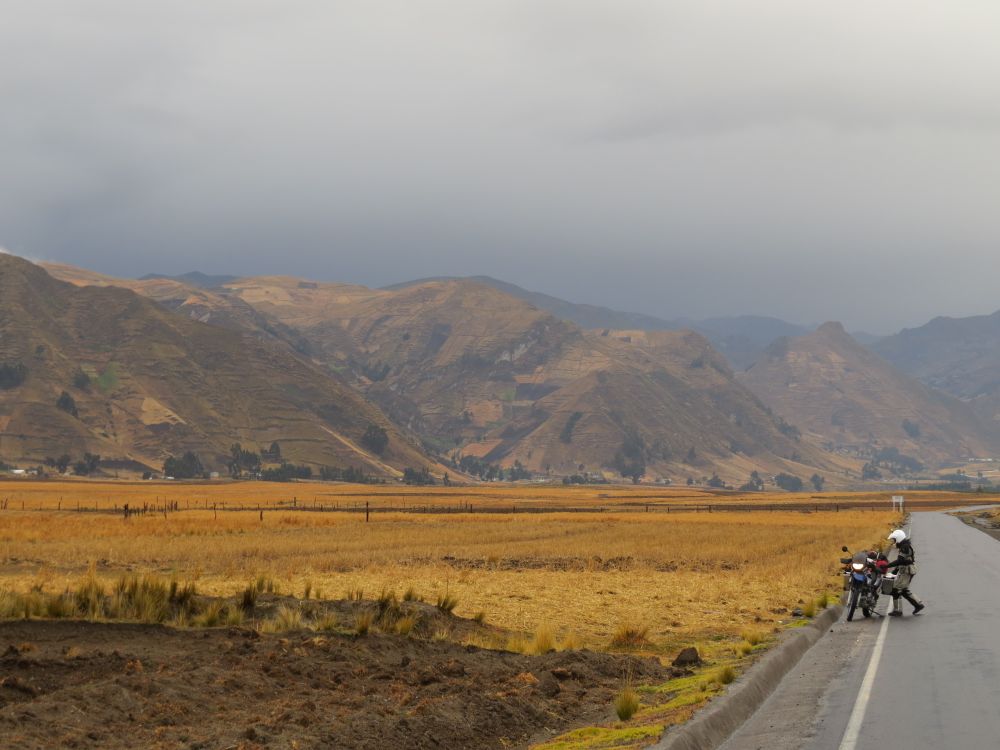
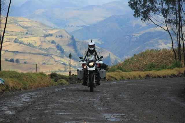
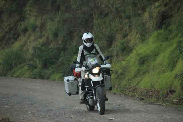
We left Chimobote, a loud and chaotic city to head into the valley of the Rio Santa. The valley starts as a very green and broad oasis in between rocky, sandy and dry mountains. Fields of all kind of vegetables show that this ground is very rich. Corn, potatoes and endless fields of sugar canes on both sides of the roads. The road is in good conditions and leads us deeper and deeper into the Andes. The mountains get higher and higher as the valley becomes more and more narrow. After approximately on hour the pavement ends and a good gravel road continues following the river. The green of the valley almost disappears, only a small stripe of green directly at the river remains. The riding is great and the roads allows high speed travelling, you can easily go 80 or partly even 100km/h. Christy is taking it more easy of course, but is constantly riding at reasonable speed. So when I want to take a nice picture of her I have to speed up for a while and get the camera out in a hurry to be able to get into a good position of a picture. I am surprised how well she is managing the bike on the gravel. The off-road training with her little Beta bike back in Germany really seemed to help her. We stop very often to take pictures and to enjoy the view of the valley, but I also try to keep us going, as I expect the Cañon de Pato, a steep canyon at the very end of todays itinerary to be a little bit more difficult and I don’t want us to end up in the dark there.

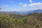
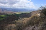
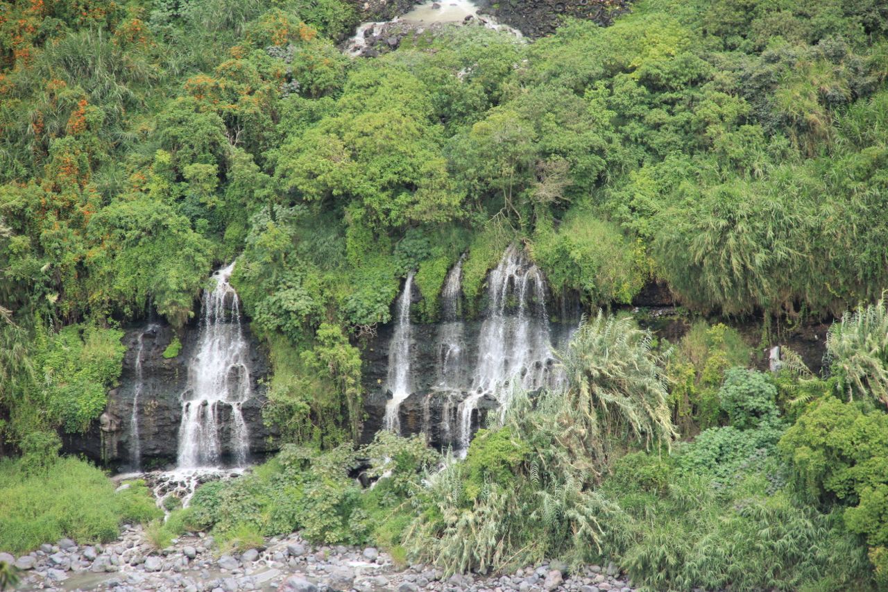
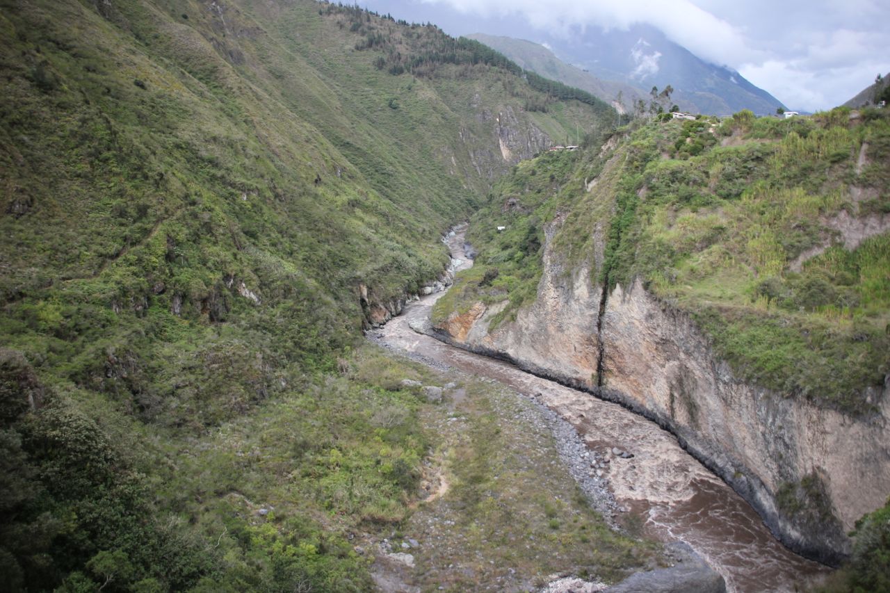
The valley is spectacular with steep walls on both sides and the dirt road winding on its ground along the river. The colors of the mountains surrounding us vary in different brown colors and areas of yellow and red earth. It is incredibly beautiful. As the valley slowly turns into a steep canyon, the road leads up the hill, offering breathtaking views into the canyon.

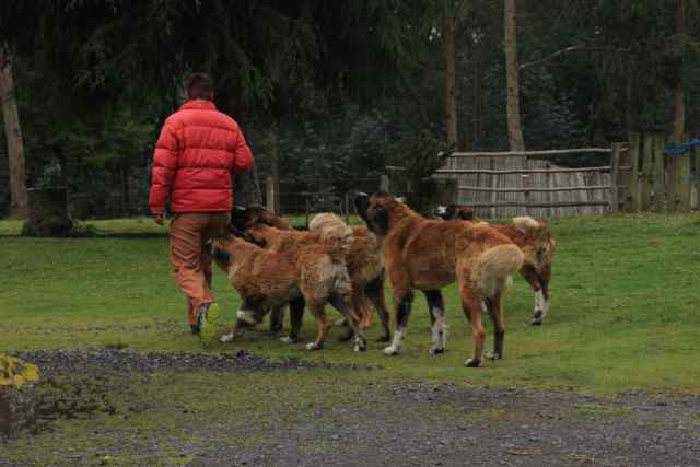
In a small village we stop to get something to drink. It is a very strange atmosphere. Many of the inhabitants sit around and look at us as we were from a different planet. As usual I try to chat them up, but other than the people in all other areas on our travel so far they are not very talkative.

So we drink our cokes in quite. The road keeps being spectacular and the walls of the canyon even get higher and the canyon narrower. This is where the Cañon de Pato begins. The walls of the canyon are just a few meters apart and fall vertically down to the bottom where the Rio Santa roars wildly. Other than I had expected, the road turns out to be very good and paved. But it is a one-way road with many small tunnels. Signs encourage you to honk before every tunnel, but I still end up facing traffic in the tunnel. So we squeeze us through the wall and the upcoming car. The road is covered with sand and only two lanes of where the car tires roll are free. There is nothing like a guardrail. If you happened to slip over the edge the next stop would be the bottom of the river, so we keep our concentration up and make a couple of breaks.

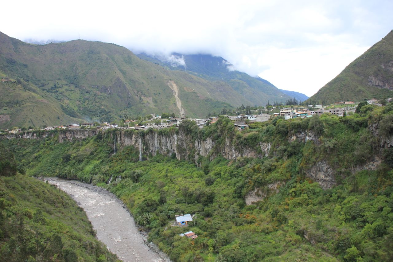
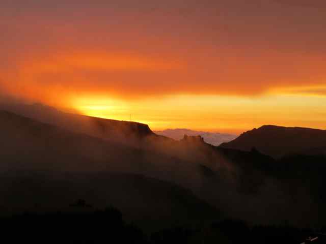
After a few kilometers the canyon opens up and the valley becomes wide again. On the left hand side the mountains of the Cordillera Blanca reach up to 6000m. They are covered in clouds though, so we can only guess about their beauty.

Because the road through the Cañon de Pato is way better than anticipated we make it to Caraz at around 3:30pm. We search a Hotel and find a nice place in the “Los Pinos Lodge”. We unload the bikes and as the clouds open up a little bit we get a short view of one of the mountains of the Cordillera Blanca. A steep snowy mountain, seen from the yard of our hotel where humming birds fly around the colorful flowers. It was mind blowing.


We decide to make a little day trip into the Cordillera Negra. It is a mountain range in the west of the valley. As the Cordillera Negra “only”reaches up to just below 5000m, the tips of the mountains are not covered in snow, other than the white summits of the Cordillera Blanca, which gives both ranges the names.

Screen Shot 2014-10-19 at 22.22.50

We expect to have a nice view into the Cordillera Blanca and get up early to use the usual better weather in the morning.

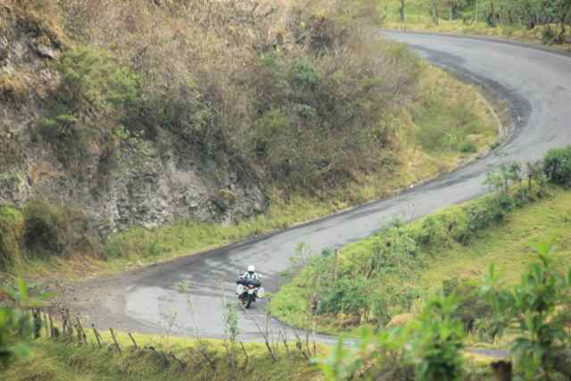
The road is very good, but very narrow. The good asphalt brings us through a small village. All houses are build in a 15th century clay brick style except the tin roofs.

In dozens of serpentines the road leads up the hill and with every curve the view into the valley is changing. The slopes of the Cordillera Blanca end in clouds that cover the tip of the mountains. They strangely only cover the Cordillera Blanca. We ride in the sun and the whole valley is sunny as well.

The mountain we ride up doesn’t seem to end, one curve after the other. Some of the serpentines are really steep, and since the road is very narrow, we are very happy that there is only little traffic. On some places the road leads all the way to the edge, where the walls go down 1500m. Again we have to keep the concentration up. Safely we arrive at a mountain pass. Instead of going on, we find a little dirt road that leads along the ridge of the mountain. We follow the track for a few kilometers until we find a spot with a great view. The clouds have moved a little bit, and it seemed as if it would clear up a little.

We sat there, watched nature slowly opening the scenery of the Cordillera Blanca. Small openings in the clouds allowed to get a little peek of the one summit, than a few minutes later of another one, as the first one gets covered again. It was fantastic. I remember the first summit I saw peeking out of the clouds. It was so high up, that I could hardly believe it was connected to the lower part of the mountain that you could see.

The sun was shining on us the whole time, but the wind was sort of cool since we were at an Altitute of over 4200m so we decided to ride down. The weather cleared up even more as we descended down the road.

The beauty of the landscape, the colors of the mountain, the white summits of the Cordillera Blanca, the incredible road and the drops next to it, it all gave us the feeling of having been a witness of a one-of-kind magic moment, even though we know the mountains have been there for millions of years and will most likely last some more.


Equipment: Action Cam Garmin Virb Elite vs. GoPro

I have been using the GoPro for a couple of years on my motorbike. I used it to video travels and a couple of rallyes I participated in. I loved it but on my last travel around the Adria I lost it (that sticker was not that well fixed on the motorbike as I thought).

So in preparation for this trip I was thinking about getting a new one. There are some things you cannot capture on a photo and I like to have some recordings of rides.

I was looking around and found the Garmin Virb Elite. Christy bought one and my friend Thomas loaned me his GoPro for the trip (thanks at this point to Thomas).

So during this trip we could compare them very well and I want to share my experience here. Not in terms of the technical data, that is something you can find elsewhere in the internet, but in terms of practical usability.

First of all:

Recording while motorbiking is really nice. Especially when travelling. Very often we just put the cameras on because the road is nice, there is a little nice village we pass through or because there is an interesting riding sequence. We film basically for two main reasons:

  1. the situation is better captured in motion
  2. we don’t want to stop to take a picture (sounds stupid, but you can not always stop)


It is great to see these movies at a later point, integrate it into a “slide-show”(sorry, I grew up in the analog world) and it is great for memories. It shows the world (that means friends and family) how we saw the places when riding.


Now as for the comparison there is not much to say about the quality. The Garmin is a lot more up to date than the Hero model I use on this trip, so there is no fair comparison. This thread should more be about the handling.


Battery

The GoPro’s batterie is a lot worse than the Garmin. When the camera is on (not filming) and filming once in a while, it does not last a whole riding day (max 6h that is on our travel so far). The Garmin has a powersaver and even though it contains a GPS device, Christy rarely ran out of battery when she had it fully powered up the night before. She is filming a lot more than I am, since I knew of the power problem before. And even if I shut down the camera completely for most of the time, the battery is always empty at some point.

There is one really cool thing worth mentioning: If you happen to use a Gamin Montana Navigation (highly recommended for bikers who also do some offroading because you can also use tracks e.g. from http://www.wikiloc.com ) you can SWITCH batteries. Virb and Montana use the same batteries. Since the Montana is will be constantly charged by the bike, you always have a fully charged “spare batterie”.

This may also be the case for other Garmin GPS, you will have to check yourself for other models though.

GPS

The Garmin Virb elite comes with an integrated GPS. That is a really nice feature for bikers. It shows the position where something was filmed (very cool on long distance travels) and shows the speed (that’s more a play thing, I wouldn’t know where this is overly interesting, but nice to have). The GoPro does not have this feature to my knowledge (maybe as an add-on device, I haven’t checked).

Waterproofness

Both devices are waterproof (at least as far as motorbikers are concerned, you cant dive with the Garmin (out of the box, there is special equipment), but you could with the GoPro.

Since you wont see anything in rain anyway (the spray on the camera lens makes a blurry image) this is only important for motorbikers so that they don’t have to stop to dismount the camera every time a little drizzle surprises them.

The Garmin is a one-unit waterproof thing. The GoPro is a non-waterproof unit that has a waterproof housing. This housing is a lot more waterproof than the Garmin (as I said, you can dive with it). That has no advantage for motorbikers, but a huge disadvantage: it condenses when temperature is falling or the air pressure changes (e.g. when climbing a mountain pass).

I had a couple of great rides filmed with the GoPro and when I wanted to see the video in the evening I had to find out that the whole scene is pretty foggy.


Use

Both systems have diverse mounting equipment available. So you can mount them in all kind of positions on the bike.

I like the 3M stickers that both of the have even though one came off and I lost my GoPro. That was certainly my own fault, there was nothing wrong with the sticker I cleaned the surface not well enough. But still you kind of lose confident a little bit.

There is one thing that always bothered me on the GoPro (and every motorbiker I know): turning camera ON and OFF is the same button. The camera makes a little beep when turned on and beeps 3 times when turned off. Additionally there is a little LED blinking while filming. That just doesn’t work on a bike. You don’t hear the beep very well, and the LED is not visible enough on bright days.

So many of my videos start with me looking in the mirror to check whether the camera is on. I also had it, that I didn’t press hard enough one time and from that time on, I was filming everything that was boring (including me making a short “pit-stop” at some remote tree, maybe not so boring after all) and not filming the interesting stuff.

Garmin has a slider button. You always know if the camera is on or off. You can feel it, even with thick gloves.

This slider wakes the camera up from the stand-by and starts recording. That’s perfect and saves battery as well.

Screen

The Garmin has a little screen, so you can check what you are actually filming. That is especially handy when mounting somewhere where you want part of the motorbike being in the image.

The GoPro has a mount-on screen, but as far as i know it is not waterproof anymore.


SO, my advice:

The GoPro as the godfather of action-cams is good for a lot of things, but not for motorbikers.

My recommodation is clearly the Garmin Virb Elite. It has everything that a motorbiker wants on his/her action cam.


Short overview:

GoPro disadvantages:

Use (on/off button is a nightmare)

Lens gets foggy

No GPS

Battery

Through the desert

Piura – Trujillo

We wanted to make it all the way to Chimbote today. So we had an early start and left the hotel at around 9. The PanAm is a very good road the goes through the desert de Sechura (Dry Desert). In the morning it was partly cloudy and once we have left the town of Piura we cruised with around 90-110 km/h through the desert. The desert changed during the drive a lot. First there were still some bushes left and right and along the road there were many little wooden barracks and houses where people are selling their goods. But soon the barracks ended and so did the bushes. The landscape became more flat and sandy. Slowly a little bit of wind came up as well. Every now and then areas of sand dunes appeared, sometimes small, sometimes as high as 50m. In some areas u-shaped dunes appeared. In a perfect sickel shape they spread as far as one could see.

In other places the desert was perfectly flat.

It is quite amazing going through that desert, knowing that the sea is only a few km from the road. The landscape was fantastic and the quick change from the last days came to my mind a couple of times. Just 3 days ago we rode through rich vegation with banana trees left and right of the street.

As it got warmer, the wind picked up on speed. After 1pm the wind got really strong and riding got difficult.

Especially with the wind coming from the side, which was the case for most of the time.

Every time we passed a truck we swerved over the rest of the road. The road got more busy in the afternoon as well, and overtaking got real nerve wrecking with other cars overtaking us as well. We had a couple of situations where we had to slow down since oncoming traffic underestimated our speed and we were faced with two trucks coming right at us.

We made a couple of short stops. The breaks where really necessary to keep the concentration up.

In total it was a very beautiful day, but also very tiring.

At 4pm we decided to stop in Trujillo instead of pushing though the rest of the 150km to Chimbote. We went to Chan-Chan, the largest pre-columbian ruins but they were already closed, so we decided to return the next day.

We ended up in the fanciest hotel in town, directly at the main plaza.

And we saw something we haven’t seen in a long time: the golden arches of McDonald. So we decided to get some good old American fast food for a change.


A little paradise

Christy was not feeling well, so we took our time in the morning. We met Daniel an American lawyer who got into mining and owns a mine just inland of Trujillo. He invited us to stay with him if we would make it to his place. He goes to the Ecuadorian border 3 times a year to leave the country for a few minutes to renew his visa. He lives in Peru since almost 2 years like this and even though he is Mexican by birth and therefore has no language barrier at all, he told us he would have problems to get used to the country. As a business man it seems to be very difficult to get used to the Peruvian attitude to work and progress which is very different to what we are used in Europe or the US.

At 3pm we decided to keep going and to make it to either a campsite which has been recommended by a Frenchman we met in Baños or to Mancora a beach city further down the road.

The road was more or less all along the ocean side and really fantastic. The deep blue sea on our right and dry desert to our left.

We arrived at Zorritos after one hour of riding and found the campsite at the coordinates we got from the French guy (S3.72356, W80.75981).

We were welcome by Melba and her husband Jacques a Swiss from the French part of Switzerland. Their two dogs werebarking at us but they calmed down immediately and it turned out the dogs were very friendly once they get to know you.

One of the dogs is a Viringo, a Peruvian race which has no hairs and develops a higher body temperature. He looks pretty scary first and it is quite strange to touch him with his elephant like skin. He is really young and likes to play a lot and we had great fun with him. He is also making the place pretty safe, scaring everybody else away, even though that was not really necessary, since the area is very tranquilo.

A French couple on a 1 1/2 year trip through South America with their Toyota stayed on the campsite as well.

The campsite is really small and still under construction. But the facilities are very clean and good. The campsite is bordered by the seaside with a perfect sand beach. So we put up our tent just a few meters away from the beach and heard the waves all night long. Melba made dinner for us and it was delicious. We had a great evening speaking a wild mixture of French, Spanish and English. We watched sunset and were standing in the waves at night. The wind was cool, but with the feet in the warm sea we enjoyed the view of the moon reflecting in the Pacific Ocean.

The place was so peaceful, relaxing and beautiful, we decided to stay two nights.

Entering Peru

From Lojas there are 3 possible crossings to Peru: one was recommended by Rafael from Freedom Bikes in Quito. It would be the most beautiful but also the one that would take the most time.

A direct route would take us directly into a desert in northern Peru.

The option we would take was to go to the coast. We figured we had enough cold days and wanted to have a nice coastal road. So we drove to the boarder crossing close to Tumbes.

The ride was amazing. The whole day curves. First on a large road with nice long curves that were very nice to ride, later on a smaller, but still very good road down from 3000m to sea level. The air became quickly warmer and the more humid. The vegetation changed from green grasslands to more exotic banana plants.

Christy’s riding improved noticeably during this day, with the hundreds of curves giving her plenty of learning possibilities.

The road was very nice to ride, but you had to be very concentrated. Not only because of the curvy road, but also because of obstacles like cows, cars, donkeys that just stand around on the road. Sometimes parts of the street were missing due to landslides.

We made it to Huaquillas, the boardertown, at around 4pm.

Originally we wanted to go to the city and get money for the crossing, but the road goes around the city and so we ended up at the boarder. It took us 3 hours to cross (including returning to the city to get money and go to customs, which is actually 5km before the border).

So we entered Peru at 7pm, one hour after it became dark. The next hotel was 35km away. So we did what we always wanted to avoid, riding overland in the dark. We took our time. It was still difficult and we were super concentrated. The driving attitude dropped once we entered Peru. Cars pull in without signals, cars overtake in the most ridiculous situations, people cross the street without looking and worst are the little 3-wheeled taxis. They turn in the middle of the street and move left and right with no warning. We made it into Tumbes which turned out to be a very chaotic and loud city. Maybe it would be really nice and vivid if you were in a mood for it, but we were just tired. So we parked the bikes in the Costa del Sol Hotel, had dinner and went off to bed without even having a little walk into the city.

Hats and colonial towns

We stayed in Cuenca 4 1/2 days and had some Spanish lessons. The town is an old colonial town with small streets, all one way which creates long traffic jams in the morning and the evening. Ecuador is the home of the Panama hat, which workers wore when constructing the panama canal. So this is how it got its name. You see the hats everywhere on the street. So we decided to visit a company where these hats are produced. It quite impressive how they do this, a done with machines which seem to be 100years old and a lot by means of the hands of experienced workers. The production site is quite famous and lots of celebrities have been there to visit. We left Alberto and his nice and friendly personal at around 1:30 since Christy had Spanish lessons in the morning. The countryside kept being beautiful. The road led through the mountains and went from 3500m down to 2000m and back up to 3500 within few kilometers. In some areas the landscape looked like Bavaria. Sheep and cows standing around on the meadows chewing up the fresh green grass.

It was pretty cold that day and we were freezing a lot.

It got slowly dark and after a nice sunset on the road we arrived in the dark in Lojas. We found a real nice restaurant around the corner of the hotel and went to bed real tired.


Incredible Mountain roads to Cuenca

We had an early start, and again we had fantastic riding days on our way to Cuenca. The road crosses the Sangay NP. The scenery is fantastic, great views into the lower valleys, the vegetation still being incredibly rich. The air gets cooler and the landscape seems to change with every 15 minutes of riding. As we reached the highest point of the road the landscape reminds me a lot of Scotland, a mere 2 hour ride away from the deepest rainforest you can imagine.

Due to the cloudy sky we were not lucky enough to see the Sangay mountain itself, a 5300m glacier covered volcano which arises from the jungle.


There are very few cars and almost no trucks on the road. The riding itself is fantastic, new tarmac on perfect curves that makes every motorbiker smile. It was a nice and smooth riding today even though we hit some heavy rain as we covered the last couple of kilometers on our way to Alausi where we stayed for the night.

We kept following the Panamericana which at this stage is a very beautiful road winding through the mountains. Christy is improving a lot on her riding, and it is fantastic to see how much she is gaining confidence with all these curves and steep slopes.

We stopped at Ingapirca, the most important Inca ruins in Ecuador. The precision of how they put together the rocks to build their walls is stunning. I have heard of it before, but seeing it with our own eyes was very special and quite impressive.


We approach Cuenca pretty early and find a fantastic hotel where we plan to stay for a couple of days to get some Spanish lessons.

Into the jungle

The road leading from Baños to Puyo is called the road of waterfalls. And indeed we saw many of them. The valley in which we drove has the water coming from both sides, creating small and large waterfalls. There are many small cable cars that lead to them, it seems to be a very popular thing here in Ecuador.

Nice waterfall

Nice waterfall

The road to Punyo is called the road of waterfalls for a reason

The road to Puyo is called the road of waterfalls for a reason

IMG_0557 copy

With every km the vegation became richer and the air heavier as we are approaching the amazonas low lands of Ecuador. We find a little hotel which we approach over a small bridge which is actually for pedestrians only.

Christy enjoying the view during a break

Christy enjoying the view during a break


The next day we visit a small park where an amercian married to an indigines women shows the tradional way of living of the indian tribes from the amazon. His wife, born and raised in a tradional way, teached him the medical treatments the indigenes people do with all the different plants. He walked us through the park and explained a lot about the use of the plants and their characteristics, like the walking tree which actually walks up to 3m in a few years to optimize his position to gain more light.

A walking tree

Chris Canaday explaining a walking tree

We saw a lot of different small animals, like the bull ant, a giant ant that is quite peaceful but should be avoided due to its quite painful bite. He showed us a street of cutter ants dragging huge pieces of leaves to their home to fertilize a certain mushroom which they eat.

Cutting ants on their little procession

Cutting ants on their little procession

The variety of plants are incredible. And we learned (and already forgot) about the medical use of many of them..

The variety of plants are incredible. And we learned (and already forgot) about the medical use of many of them.

This one is just good for beauty I guess

This one is just good for beauty I guess

It was quite interesting and it was steaming hot when we finally returned to the hotel to pack our bikes.

The road to Macas is brand new, as most of the roads in Ecuador. The current president takes a lot of effort to invest into the infrastructure of the country.

On the road to Macas

On the road to Macas

Left and right of the road the jungle spreads, on the right side bordered by the mountains on the left side spreading endlessly to the horizon.

Riding was very relaxing.

Riding was very relaxing.

We arrive in Macas after dark. As we stopped to get something to drink, two police officers chat Christy up. They are curios about our travel and help us with the directions of the hotel we want to stay in. That’s how we end up with a police escort through the small town to our little hotel.

Christy started to take over the navigation.

Christy started to take over the navigation.

A giant’s burp

Baños is a very touristy little town with lots of outdoors activities going on. The climate is very nice, around 25 degrees, not humid, just nice and friendly. We had a little break there, taking care of our blog, did some laundry, reading and took half a day of Spanish lessons.

View on Banos

The town is situated directly underneath the Tungurahua volcano, which is not only active, but erupting momentarily. Just a few weeks ago a couple of explosions combined with lava flow and hot ashes floating down to the valley scared the inhabitants of Baños.

The danger is very present. Everywhere within the city there are emergency signs, showing the directions to the evacuation routes. In case of a larger eruption the population is meant to leave the valley on the opposite side of the volcano.

View on Banos

View of Baños

As we were sitting in our room one evening, suddenly a loud noise made us jump to our feed. The whole ground shook. We nervously looked at each other having both the possibility of a large eruption in mind.

After a few seconds the whole thing was over. We opened the window to hear whether there would be any sirens. We stood there at the window a few minutes, but beside the usual barking of the neighborhood dogs there was nothing to hear. So we decided that this was not that bad after all. We looked up the volcano in Google whether we could see some information, and indeed there was some sort of explosion at the Tungurahua that was shown on some seismographic measurement stations around. But in comparison to what the graph looks like on a “real” eruption it was clear this was only a small burp of this giant.

The little "burp"visible on the live measurement data

The little “burp” visible on the live measurement data

thats how it looks when it you should get ready to run (recorded August this year)

thats how it looks when it you should get ready to run (recorded August this year)

The Tungurahua volcano

The Tungurahua volcano


The volcano is momentarily erupting

The volcano is momentarily erupting

There are several viewpoints on the volcano, but since it was cloudy most of the days we didn’t go there. On the day of our departure from Baños we drove up the mountain opposite of the volcano to have a view. It was still in clouds, but as we were sitting up there the sky cleared up and we had a wonderful view on the Tungurahua.

The road to Quilotoa Crater

One of the places we wanted to see is the Quilotoa crater. The crater is filled with water, creating a great lake with steep walls that made the Incas believe the lake had no ground.

As so often the ride to Quilotoa crater proofed that motorbiking is more about the roads you ride on than the destinies you are actually going to.

Right after Latacunga the road led up the mountain in steep curves, offering a beautiful view into the valley and the momentarily erupting volcano of Tungurahua. We turned into a dirt road to get away from the main street for a short break. In the distance we could see a shepherd guarding his sheep and slowly moving from one place to the next, taking a short nap every time he moved himself for 100m.

Getting off the road for a little break

The road kept curling through the mountains, which got steeper and rockier. Dark clouds moved in and we realized we would end up in the middle of a thunderstorm. We looked for a shelter and found it underneath the roof of a gas station where we waited for the rain to stop. The rain has cleaned the air, everything smelled fresh when we continued. The landscape became wilder and it seemed the rain has intensified the colors of the surroundings. Steep mountain slopes with fields, which seemed to be hanging vertically on the side of the mountains. Everything is painted in different shades of brown and ocher. We rode into a broad valley on a winding road.

Suddenly a canyon opemsto our ride side

Suddenly a canyon opens to our ride side

Suddenly a steep canyon opens to our ride hand side. Vertical walls lead down to a wild river in the bottom of the canyon. It is a landscape like from a fantasy movie. Christy said it wouldn’t surprise her if she saw a dragon sitting next to the road somewhere. The dark clouds and the sun shining in between them, the intensive colors, all which created an out-of-this-world atmosphere.

After the thunderstorm on the way to Quilotoa

After the thunderstorm on the way to Quilotoa

We arrived at the Quilotoa crater just a few minutes before sunset, surrounded by clouds. Just as we approached the crater by foot, the clouds opened a little gap. The sun was shining right through that gap illuminating the tips of the crater and creating a fantastic double rainbow over the crater lake. It was more than beautiful. It was beyond kitsch. It was one of the most amazing views I have ever seen.

As the sun sets very quickly here so close to the equator, the whole scene only lasted a few moments before it got pitch-black.

Sunset at Quilotoa crater lake

Sunset at Quilotoa crater lake

Sunset at Quiltoa lakd

Sunset at Quiltoa lake

The next day we went back to the panamericana using another road that brought us back close to the Cotopaxi NP where we have been before.

Again we had fantastic views, another thunderstorm some dirt roads and Christy had her first little fall. Harmless and pretty unavoidable with her broad front tire and the very soft and slippery ground in a construction site of the road.

Some short dirt track sections

Some short dirt track sections

Soon the Quilotoa round will be fully asphalted

Soon the Quilotoa round will be fully asphalted

On the way back from Quilotoa

On the way back from Quilotoa

Winding roads all day long

Winding roads all day long

We ended up in a nice hostel, close to the Cotopaxi NP. A Swiss owned place with 5 huge Saint Bernard dogs that protect the place. It was quite a sight when I pulled up the place, stopping the engine and one, then two..three..finally 5 huge dogs approached and stared at me. I stood there for a moment not knowing what to do. I was afraid if I would get off the bike the calm dogs would suddenly turn into an aggressive pack of killerbeasts.

The swiss owner and his bernards

The swiss owner and his bernards

But another look at their sad and friendly eyes convinced me of their friendliness, which they immediately proved by cuddling up with me, once I got off the bike.

Dinner next to a fireplace made this day perfect.